2005 07 30 Candelaria, Marietta, Warm Springs
2005 07 31 Tonopah to Ely, Warm Springs, Tybo, Lunar Lake
2005 08 01 Ward, Thunderstorms
2005 08 02 US50 Road Cut, Grand Deposit, Stonehouse
2005 07 30 Candelaria, Marietta, Warm Springs
Candelaria is an old mine site that I have visited once already. This trip I thought I would shoot some of the same material but use a new film.
 |
 |
 |
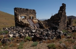
This is one of the two ten foot tall iron doors on what must have been a local bank. There is a small safe in the sage not too far from here. Candelaria is one of the many mines in Nevada that have had at least two lives. Not far from the small tunnel diggings here there is a huge open pit, also abandoned. Many of these open pits are filling with water, and have become toxic. (This document might be a useful guide to interesting and colorful bodies of water.)
 |
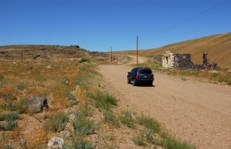
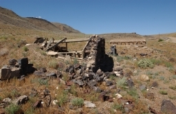
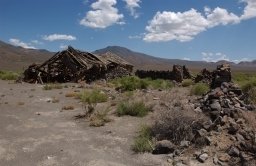
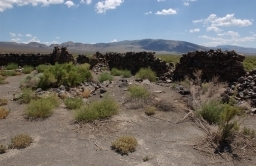
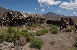
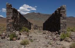
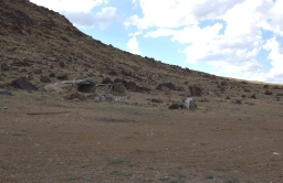
Not far from Candelaria are the remains of Marietta, which is on the edge of a dry lake bed. There was mining here, but also extraction of borax from the lakebed. Not much is left, an old farm is the largest set of structures, and the two long stone walls of the old store still stand. There are some structures up in the hills near the old mines, but it was too late and too hot to make the drive.
 |
 |
 |
 |
While poking around here at Marietta I noticed a cloud of dust off in the distance that meant a vehicle was coming. Sure enough, 10 minutes later a BLM ranger drives around a curve and then makes the turn in to where I was. I thought "OK, what have I done.." but it turns out all she wanted was to make sure I wasn't making off with any souvenirs from the sage. She said people like to take the square nails from old buildings.
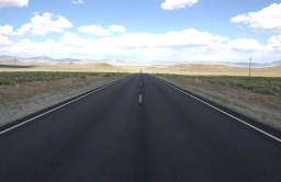
After looking at Marietta and the dry lake I drove back to US6 to Tonopah and then further east to Warm Springs, at the intersection of US6 and Nevada 375. Warm Springs is named for the very nice warm springs which is about 300 yards up the hill from the highway intersection. A channel has been made to take the water down to the pool near the road and then off into the sage. At one time there was a ranch here, and you still see range cattle here. The ranch is long abandoned, but someone operated a restaurant and pool here until not too long ago. There is quite a flow out of the springs and the water is a very nice temperature. The intersection of 6 and 375, as well as the channel down from the hillside, are clearly visible from the air. There is a rough road along the channel and it is all white from minerals in the water. It's very easy to see from the air.
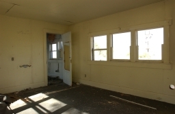
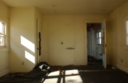
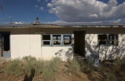
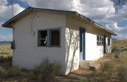
The next four snaps are of one of the several more recent buildings that were part of the bathhouse and pool.
 |
 |
 |
 |
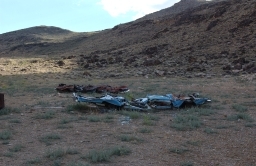
Someone saw fit to dump about a half dozen squashed car bodies here. They apparently could not be bothered to take them wherever they were supposed to go.
 |
 |
 |
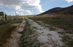 |
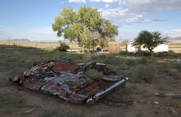
The lower right snap in the above group shows the road that goes from the pool and bathhouse up to the spring itself. The lower left is of some of the remains of the old ranch.
 |
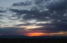 |
These last two shots are on US6 on the way back to Tonopah. I thought the sunset might amount to something but it didn't.